
Carte topographique Cambusmichael Burn
Carte interactive
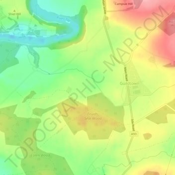
Cliquez sur la carte pour afficher l’altitude.
À propos de cette carte
Nom : Carte topographique Cambusmichael Burn, altitude, relief.
Altitude moyenne : 65 m
Altitude minimum : 8 m
Altitude maximum : 127 m
Autres cartes topographiques
Cliquez sur une carte pour visualiser sa topographie, son altitude et son relief.
Tarduff Burn
United Kingdom > Scotland > Perth
Tarduff Burn, Perth, Perth and Kinross, Scotland, PH1, United Kingdom
Altitude moyenne : 178 m
Balhousie Castle
United Kingdom > Scotland > Perth
Balhousie Castle, Hay Street, Muirton, Perth, Perth and Kinross, Scotland, PH1, United Kingdom
Altitude moyenne : 22 m