
Carte topographique Githunguri
Carte interactive
Cliquez sur la carte pour afficher l’altitude.
À propos de cette carte
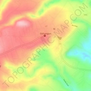
Nom : Carte topographique Githunguri, altitude, relief.
Lieu : Githunguri, Kiambu County, Central Kenya, Kenya (-1.06648 36.76487 -1.05377 36.78642)
Altitude moyenne : 1 930 m
Altitude minimum : 1 821 m
Altitude maximum : 1 999 m