
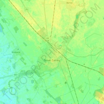
Carte topographique Nové Zámky
Carte interactive
Cliquez sur la carte pour afficher l’altitude.
À propos de cette carte
Nom : Carte topographique Nové Zámky, altitude, relief.
Altitude moyenne : 116 m
Altitude minimum : 108 m
Altitude maximum : 126 m
The town is located on the Danubian Lowland, on the Nitra River, at an altitude of 119 metres. It is located around 100 km from Bratislava and around 25 km from the Hungarian border. It is a road and railway hub of southern Slovakia.
Autres cartes topographiques
Cliquez sur une carte pour visualiser sa topographie, son altitude et son relief.
Rastislavice
Slovakia > Region of Nitra > District of Nové Zámky
Rastislavice, District of Nové Zámky, Region of Nitra, Western Slovakia, 941 08, Slovakia
Altitude moyenne : 125 m
Strekov
Slovakia > Region of Nitra > District of Nové Zámky
Strekov, District of Nové Zámky, Region of Nitra, Western Slovakia, 941 37, Slovakia
Altitude moyenne : 163 m
Štúrovo
Slovakia > Region of Nitra > District of Nové Zámky
Štúrovo, District of Nové Zámky, Region of Nitra, Western Slovakia, Slovakia
Altitude moyenne : 115 m