
Carte topographique Tanggula Mountains
Carte interactive
Cliquez sur la carte pour afficher l’altitude.
À propos de cette carte
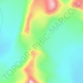
Nom : Carte topographique Tanggula Mountains, altitude, relief.
Altitude moyenne : 5 912 m
Altitude minimum : 5 811 m
Altitude maximum : 6 149 m
The elevations of the main ridge average more than 5,000 m (16,404 ft). The Yangtze River originates in this mountain range; Geladandong, 6,621 metres or 21,722 feet high, located in Tanggula Town, is the tallest peak in the range.