
Carte topographique Fort Collins
Carte interactive
Cliquez sur la carte pour afficher l’altitude.
À propos de cette carte
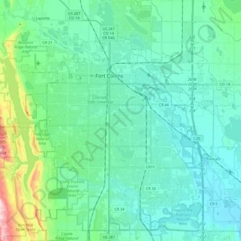
Nom : Carte topographique Fort Collins, altitude, relief.
Lieu : Fort Collins, Larimer County, Colorado, United States (40.47261 -105.15736 40.63935 -104.98200)
Altitude moyenne : 1 548 m
Altitude minimum : 1 462 m
Altitude maximum : 1 956 m
Fort Collins is situated at the base of the Rocky Mountain foothills of the northern Front Range, approximately 60 miles (97 km) north of Denver, Colorado, and 45 miles (72 km) south of Cheyenne, Wyoming. Elevation is 4,982 ft (1,519 m) above sea level. Geographic landmarks include Horsetooth Reservoir and Horsetooth Mountain—so named because of a tooth-shaped granite rock that dominates the city's western skyline. Longs Peak can also clearly be seen on a clear day to the southwest of the city.