
Carte topographique Tawang
Cliquez sur la carte pour afficher l’altitude.
Tawang
Tawang is situated 448 km north-west of state capital Itanagar at an elevation of approximately 3,048 metres (10,000 ft). It lies to the north of the Tawang Chu river valley, roughly 10 miles (16 km) south of the Line of Actual Control with China. It is the site of a famous Gelugpa Buddhist Monastery.
À propos de cette carte
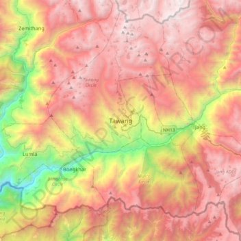
Nom : Carte topographique Tawang, altitude, relief.
Altitude moyenne : 3 280 m
Altitude minimum : 1 170 m
Altitude maximum : 4 913 m