
Carte topographique Medstead
Carte interactive
Cliquez sur la carte pour afficher l’altitude.
Medstead
Medstead is a village and civil parish in the East Hampshire district of Hampshire, England. Its nearest town is Alton, which lies 4.3 miles (6.9 km) northeast of the village. According to the 2011 census, the village had a population of 2,036 people. The parish covers an area of 1,536 acres (622 ha) and has an average elevation of approximately 600 feet (180 m) above sea level. One of the county's high points at 716 feet (218 m), King's Hill, runs through Medstead and Bentworth.
À propos de cette carte
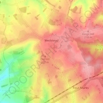
Nom : Carte topographique Medstead, altitude, relief.
Lieu : Medstead, East Hampshire, Hampshire, England, United Kingdom (51.10494 -1.09543 51.14600 -1.03704)
Altitude moyenne : 185 m
Altitude minimum : 114 m
Altitude maximum : 224 m