
Carte topographique Nevado Salkantay
Carte interactive
Cliquez sur la carte pour afficher l’altitude.
Nevado Salkantay
Salcantay, Salkantay or Sallqantay (in Quechua) is the highest peak in the Vilcabamba mountain range, part of the Peruvian Andes. It is located in the Cusco Region, about 60 km (40 mi) west-northwest of the city of Cusco. It is the 38th-highest peak in the Andes and the twelfth-highest in Peru. However, as a range highpoint in deeply incised terrain, it is the second most topographically prominent peak in the country, after Huascarán.
À propos de cette carte
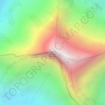
Nom : Carte topographique Nevado Salkantay, altitude, relief.
Lieu : Nevado Salkantay, Mollepata, Province of Anta, Cusco, Peru (-13.33284 -72.54722 -13.33274 -72.54712)
Altitude moyenne : 5 266 m
Altitude minimum : 4 458 m
Altitude maximum : 6 238 m