
Carte topographique Trepalle
Carte interactive
Cliquez sur la carte pour afficher l’altitude.
À propos de cette carte
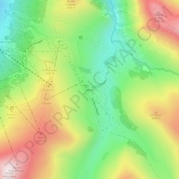
Nom : Carte topographique Trepalle, altitude, relief.
Altitude moyenne : 2 236 m
Altitude minimum : 1 816 m
Altitude maximum : 2 781 m
Trepalle is a village (the highest in Italy) in the Italian Alps, a frazione of Livigno, Lombardy. It is sometimes considered to be the village located at the highest altitude in Europe with its church located at an altitude of 2,069 m, and the village stretching up to the Passo d'Eira at 2,209 m. However, Kurush in southern Dagestan in Russia is situated much higher at 2480–2560 m in the northern Caucasus Mountains.