
Carte topographique Lubin
Carte interactive
Cliquez sur la carte pour afficher l’altitude.
À propos de cette carte
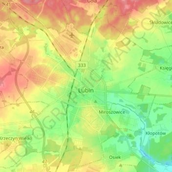
Nom : Carte topographique Lubin, altitude, relief.
Lieu : Lubin, Lubin County, Lower Silesian Voivodeship, Poland (51.35897 16.12963 51.43987 16.25825)
Altitude moyenne : 140 m
Altitude minimum : 105 m
Altitude maximum : 179 m
Autres cartes topographiques
Cliquez sur une carte pour visualiser sa topographie, son altitude et son relief.
Lubin
Poland > Lower Silesian Voivodeship > Lubin County > Lubin
Lubin, Lubin County, Lower Silesian Voivodeship, Poland
Altitude moyenne : 141 m