Carte topographique Jammu
Cliquez sur la carte pour afficher l’altitude.
Jammu
Jammu is located at 32°44′N 74°52′E / 32.73°N 74.87°E / 32.73; 74.87. It has an average elevation of 300 m (980 ft). Jammu city is situated on a series of uneven ridges of low heights in the Shivalik hills. It is surrounded by the Shivalik range to the north, east, and southeast while the Trikuta Range borders it in the northwest. It is approximately 600 kilometres (370 mi) from the national capital, New Delhi.
À propos de cette carte
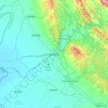
Nom : Carte topographique Jammu, altitude, relief.
Lieu : Jammu, Jammu district, Jammu and Kashmir, 180001, India (32.55856 74.69809 32.87856 75.01809)
Altitude moyenne : 367 m
Altitude minimum : 255 m
Altitude maximum : 987 m
Autres cartes topographiques
Cliquez sur une carte pour visualiser sa topographie, son altitude et son relief.