
Carte topographique Honghe Hani Rice Terraces
Carte interactive
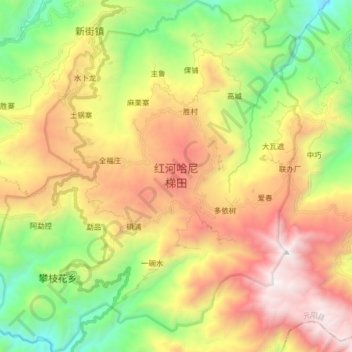
Cliquez sur la carte pour afficher l’altitude.
À propos de cette carte
Nom : Carte topographique Honghe Hani Rice Terraces, altitude, relief.
Altitude moyenne : 1 585 m
Altitude minimum : 559 m
Altitude maximum : 2 849 m
The terraces follow a distinct vertical structure that has allowed the landscape to persist for so long, incorporating forests, villages, terraces, and water supply. At the tops of the mountains (above 2000 meters in elevation), the forests are conserved, to act as a catchment for the rainfall and to "recharge" the fields and terraces below. An intricate system of canals and ditches divert the water into the terraces below. The villages in the region are usually constructed just below the forests, between 1400 and 2000 m. In the World Heritage Site, 82 villages, each with 50-100 households, are protected. The buildings are usually made of adobe and stone. Each household farms one or two terrace plots below, usually growing red rice and breeding cattle.