Carte topographique Lonavala
Cliquez sur la carte pour afficher l’altitude.
Lonavala
Adjacent to the Lohagad fort lies the visapur fort which is part of the Lohagad-Visapur fortification. Visapur Fort is larger and at a higher elevation than its twin- Lohagad. It was built during 1713-1720 CE by Balaji Vishwanath.
À propos de cette carte
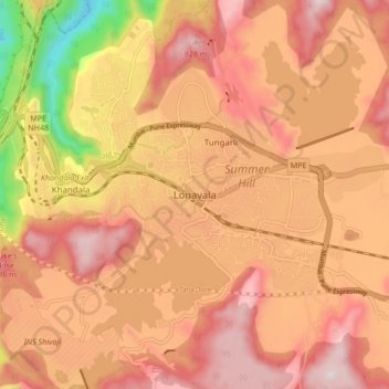
Nom : Carte topographique Lonavala, altitude, relief.
Lieu : Lonavala, Mawal, Pune District, Maharashtra, 410400, India (18.71486 73.36167 18.79486 73.44167)
Altitude moyenne : 613 m
Altitude minimum : 136 m
Altitude maximum : 882 m
Autres cartes topographiques
Cliquez sur une carte pour visualiser sa topographie, son altitude et son relief.