
Carte topographique Tempelhof
Carte interactive
Cliquez sur la carte pour afficher l’altitude.
À propos de cette carte
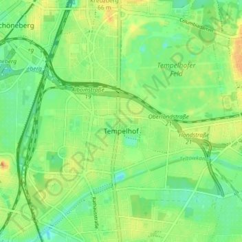
Nom : Carte topographique Tempelhof, altitude, relief.
Lieu : Tempelhof, Tempelhof-Schöneberg, Berlin, Germany (52.44414 13.35571 52.48582 13.42659)
Altitude moyenne : 47 m
Altitude minimum : 33 m
Altitude maximum : 64 m
Autres cartes topographiques
Cliquez sur une carte pour visualiser sa topographie, son altitude et son relief.
Flughafensee
Flughafensee, Tegel, Reinickendorf, Berlin, 13405, Germany
Altitude moyenne : 35 m
Schöneberg
Schöneberg, Tempelhof-Schöneberg, Berlin, Germany
Altitude moyenne : 46 m