
Carte topographique Mount Venamo
Carte interactive
Cliquez sur la carte pour afficher l’altitude.
À propos de cette carte
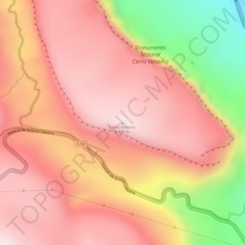
Nom : Carte topographique Mount Venamo, altitude, relief.
Altitude moyenne : 1 293 m
Altitude minimum : 971 m
Altitude maximum : 1 437 m
A mountain in Guyana named Waukauyengtipu is often mistakenly synonymized with Mount Venamo, yet they are separate plateaus and each should be recognized by their respective, separate names. Most of the information about the true location and elevation of Cerro Venamo is taken from the results of Julian A. Steyermark's and G. C. K. Dunsterville's botanical exploration of the mountain in Venezuela in 1963 and 1964. Due to the assumptions regarding the geography of the massif having been made with only the instrumentation available at that time, some information, especially its area and elevation, has proven to be inaccurate when compared to modern satellite data. Waukauyengtipu is situated approximately 27 km southeast of Cerro Venamo.