
Carte topographique Whidbey Island
Carte interactive
Cliquez sur la carte pour afficher l’altitude.
À propos de cette carte
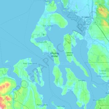
Nom : Carte topographique Whidbey Island, altitude, relief.
Lieu : Whidbey Island, Island County, Washington, United States (47.90492 -122.76999 48.41132 -122.34936)
Altitude moyenne : 45 m
Altitude minimum : -4 m
Altitude maximum : 993 m
Whidbey Island lies partially in the rain shadow of the Olympic Mountain Range to the west, and has a variety of climate zones. This can be observed by rainfall amounts – wettest in the south with average rainfall of 36 inches (910 mm), driest in the central district of Coupeville with average rainfall of 20 to 22 inches (510 to 560 mm), and turning moister again farther north with average rainfall of 32 inches (810 mm). Microclimates abound, determined by proximity to water, elevation and prevailing winds.
Autres cartes topographiques
Cliquez sur une carte pour visualiser sa topographie, son altitude et son relief.
Oak Harbor
United States > Washington > Island County
Oak Harbor, Island County, Washington, United States
Altitude moyenne : 31 m
Keystone
United States > Washington > Island County
Keystone, Island County, Washington, United States
Altitude moyenne : 2 m
Clinton
United States > Washington > Island County
Clinton, Island County, Washington, 98236, United States
Altitude moyenne : 48 m
San de Fuca
United States > Washington > Island County
San de Fuca, Island County, Washington, United States
Altitude moyenne : 31 m
Glendale
United States > Washington > Island County
Glendale, Island County, Washington, 98275, United States
Altitude moyenne : 44 m
Cornet
United States > Washington > Island County
Cornet, Island County, Washington, United States
Altitude moyenne : 54 m
Maxwelton
United States > Washington > Island County
Maxwelton, Island County, Washington, United States
Altitude moyenne : 27 m
Mabana
United States > Washington > Island County
Mabana, Island County, Washington, United States
Altitude moyenne : 23 m
Bayview
United States > Washington > Island County
Bayview, Island County, Washington, 98260, United States
Altitude moyenne : 47 m
Baby Island Heights
United States > Washington > Island County
Baby Island Heights, Island County, Washington, United States
Altitude moyenne : 19 m
Langley
United States > Washington > Island County
Langley, Island County, Washington, United States
Altitude moyenne : 48 m
Camano Island
United States > Washington > Island County
Camano Island, Island County, Washington, 98282, United States
Altitude moyenne : 27 m
Puget Sound
United States > Washington > Island County
Puget Sound, Island County, Washington, United States
Altitude moyenne : 0 m
Camano
United States > Washington > Island County
Camano, Island County, Washington, 98282, United States
Altitude moyenne : 31 m
Libbey Beach County Park
United States > Washington > Island County
Libbey Beach County Park, Island County, Washington, United States
Altitude moyenne : 21 m
Freeland
United States > Washington > Island County
Freeland, Island County, Washington, 98249, United States
Altitude moyenne : 37 m
Coupeville
United States > Washington > Island County
Coupeville, Island County, Washington, United States
Altitude moyenne : 27 m
Clinton
United States > Washington > Island County > Clinton
Clinton, Island County, Washington, United States
Altitude moyenne : 33 m
Long Beach
United States > Washington > Island County > Long Beach
Long Beach, Island County, Washington, 98282, United States
Altitude moyenne : 11 m
Coupeville, Washington
United States > Washington > Island County
Coupeville, Washington, Island County, Washington, United States
Altitude moyenne : 29 m
Greenbank
United States > Washington > Island County
Greenbank, Island County, Washington, 98253, United States
Altitude moyenne : 39 m
Fort Casey
United States > Washington > Island County
Fort Casey, South Fort Casey Road, Island County, Washington, United States
Altitude moyenne : 1 m