
Carte topographique 和平县
Carte interactive
Cliquez sur la carte pour afficher l’altitude.
À propos de cette carte
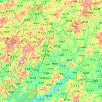
Nom : Carte topographique 和平县, altitude, relief.
Lieu : 和平县, Heyuan City, Guangdong, China (23.80004 114.36828 25.08004 115.64828)
Altitude moyenne : 351 m
Altitude minimum : 37 m
Altitude maximum : 1 324 m
Autres cartes topographiques
Cliquez sur une carte pour visualiser sa topographie, son altitude et son relief.
Guangzhou City
China > Guangdong > Guangzhou City
Guangzhou, Yuexiu District, Guangzhou City, Guangdong, 510030, China
Altitude moyenne : 21 m
Nanhu Sub-district
China > Guangdong > Shenzhen City > Nanhu Sub-district
Nanhu Sub-district, Luohu District, Shenzhen City, Guangdong, 518000, China
Altitude moyenne : 29 m