
Carte topographique Pinedale
Carte interactive
Cliquez sur la carte pour afficher l’altitude.
Pinedale
Pinedale is located at 42°51′58″N 109°51′53″W / 42.86611°N 109.86472°W / 42.86611; -109.86472 (42.866162, −109.864622) and sits at an elevation of 7,175 feet above sea level. According to the United States Census Bureau, the town has a total area of 2.15 square miles (5.57 km2), all of it land.
À propos de cette carte
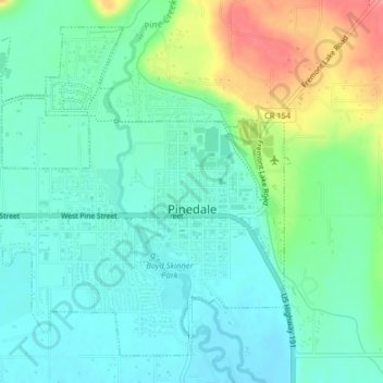
Nom : Carte topographique Pinedale, altitude, relief.
Altitude moyenne : 2 199 m
Altitude minimum : 2 177 m
Altitude maximum : 2 253 m