
Carte topographique Campo de Criptana
Carte interactive
Cliquez sur la carte pour afficher l’altitude.
À propos de cette carte
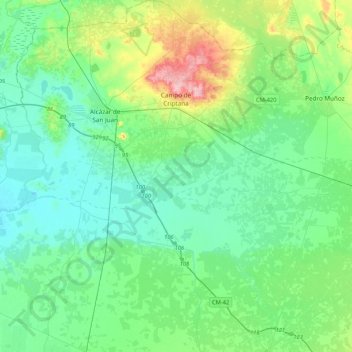
Nom : Carte topographique Campo de Criptana, altitude, relief.
Altitude moyenne : 658 m
Altitude minimum : 625 m
Altitude maximum : 775 m
The 13th century beginnings of the urban center were situated around a fortified position in the Cerro de La Paz, which served as a defensive outpost of the Castillo de Criptana. The topographical features of the area determined the formation of the city and its subsequent expansion into the plain to the south.