
Carte topographique Hohwarth
Carte interactive
Cliquez sur la carte pour afficher l’altitude.
À propos de cette carte
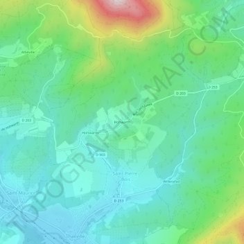
Nom : Carte topographique Hohwarth, altitude, relief.
Altitude moyenne : 376 m
Altitude minimum : 230 m
Altitude maximum : 821 m
Autres cartes topographiques
Cliquez sur une carte pour visualiser sa topographie, son altitude et son relief.
Hohwarth
France > Grand Est > Bas-Rhin > Saint-Pierre-Bois
Hohwarth, Saint-Pierre-Bois, Sélestat-Erstein, Bas-Rhin, Grand Est, France métropolitaine, 67220, France
Altitude moyenne : 352 m