

Carte topographique Thiruvalla
Cliquez sur la carte pour afficher l’altitude.
Thiruvalla
Thiruvalla lies at an altitude of 14 meters above sea level, along the north bank of the Manimala river. Thiruvalla is criss-crossed by many natural canals (known as "thodu" in Malayalam) like Chanthathodu and Manippuzha.
À propos de cette carte
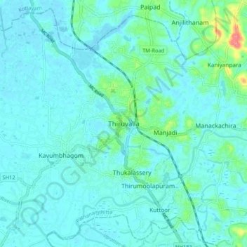
Nom : Carte topographique Thiruvalla, altitude, relief.
Lieu : Thiruvalla, Pathanamthitta, Kerala, 689111, India (9.34674 76.53627 9.42674 76.61627)
Altitude moyenne : 10 m
Altitude minimum : -1 m
Altitude maximum : 74 m
Autres cartes topographiques
Cliquez sur une carte pour visualiser sa topographie, son altitude et son relief.

