
Carte topographique Villagonzalo-Arenas
Carte interactive
Cliquez sur la carte pour afficher l’altitude.
À propos de cette carte
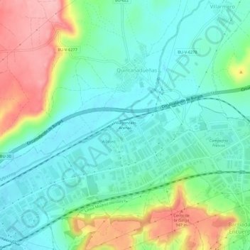
Nom : Carte topographique Villagonzalo-Arenas, altitude, relief.
Lieu : Villagonzalo-Arenas, Burgos, Castille-et-León, 09197, Espagne (42.35599 -3.75674 42.39599 -3.71674)
Altitude moyenne : 873 m
Altitude minimum : 830 m
Altitude maximum : 968 m