
Carte topographique Took
Carte interactive
Cliquez sur la carte pour afficher l’altitude.
À propos de cette carte
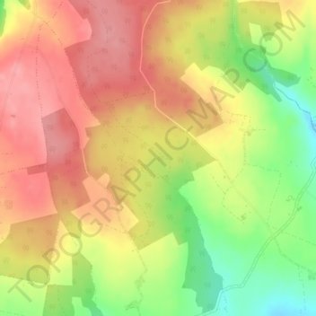
Nom : Carte topographique Took, altitude, relief.
Altitude moyenne : 169 m
Altitude minimum : 111 m
Altitude maximum : 207 m
Autres cartes topographiques
Cliquez sur une carte pour visualiser sa topographie, son altitude et son relief.
Ballymacarbry
Ballymacarbry, The Municipal District of Comeragh, County Waterford, Munster, Ireland
Altitude moyenne : 145 m
Waterford
Waterford, County Waterford, Munster, Ireland
Altitude moyenne : 33 m
Dromana
Dromana, The Municipal District of Dungarvan — Lismore, County Waterford, Munster, Ireland
Altitude moyenne : 34 m
Coolum
Coolum, Rathmoylan, Waterford City Metropolitan District, County Waterford, Munster, Ireland
Altitude moyenne : 26 m