
Carte topographique Xã Minh Thắng
Carte interactive
Cliquez sur la carte pour afficher l’altitude.
À propos de cette carte
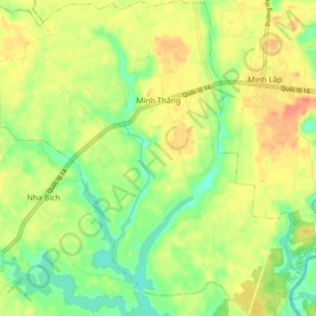
Nom : Carte topographique Xã Minh Thắng, altitude, relief.
Lieu : Xã Minh Thắng, Chơn Thành Town, Bình Phước Province, Vietnam (11.46332 106.68005 11.53739 106.75346)
Altitude moyenne : 59 m
Altitude minimum : 35 m
Altitude maximum : 82 m