
Carte topographique Moy Burn
Carte interactive
Cliquez sur la carte pour afficher l’altitude.
À propos de cette carte
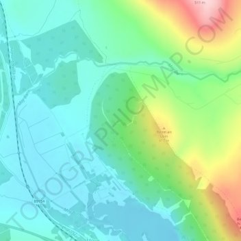
Nom : Carte topographique Moy Burn, altitude, relief.
Lieu : Moy Burn, Moy, Highland, Scotland, IV13 7YF, United Kingdom (57.38974 -4.06909 57.40707 -4.01193)
Altitude moyenne : 328 m
Altitude minimum : 265 m
Altitude maximum : 503 m
Autres cartes topographiques
Cliquez sur une carte pour visualiser sa topographie, son altitude et son relief.