
Carte topographique Mount Andre
Cliquez sur la carte pour afficher l’altitude.
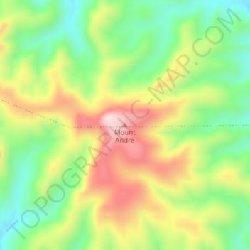
À propos de cette carte
Nom : Carte topographique Mount Andre, altitude, relief.
Altitude moyenne : 793 m
Altitude minimum : 642 m
Altitude maximum : 984 m
Autres cartes topographiques
Cliquez sur une carte pour visualiser sa topographie, son altitude et son relief.
Stirling
Many deciduous trees, particularly the maple, elm, oak and ash trees, have been imported from Europe and North America. These trees flourish in Stirling's wet and mild to cool climate and are a popular tourist attraction in the autumn months (April–May), bringing rich and vibrant autumn leaf colour to the…
Altitude moyenne : 504 m
Adelaide
Australia > South Australia > Adelaide City Council
South Australia was officially established as a British Province in England in February 1836. The first governor proclaimed the commencement of colonial government in South Australia on 28 December 1836, near The Old Gum Tree in what is now the suburb of Glenelg North. The event is commemorated in South…
Altitude moyenne : 146 m
Ikara-Flinders Ranges National Park
Australia > South Australia > Pastoral Unincorporated Area
Altitude moyenne : 430 m
Mount Barker
Mount Barker is located on the plains surrounding the Mount Barker Summit, about 2 km west of the mountain itself, at 35°04′S 138°51′E / 35.067°S 138.850°E / -35.067; 138.850. Mount Barker is south east of Mount Lofty and Adelaide. It is to the north of The Coorong, and the west of Murray…
Altitude moyenne : 368 m
Gumeracha
Gumeracha is also home to Applewood Distillery, Australia's highest altitude distillery, specialising in Gin and Amaro showcasing native Australian botanicals like finger limes and strawberry gum.
Altitude moyenne : 408 m
Williamstown
Williamstown has an elevation of 310 m and an average rainfall of 680 mm. It has a summer average temperature of 31 °C with temperatures often reaching the mid 40s, and a winter average temperature of 15 °C, with nights dropping below freezing, which makes the region excellent for the cultivation of fruits,…
Altitude moyenne : 310 m
Lyndoch
Lyndoch is a town in Barossa Valley, located on the Barossa Valley Highway between Gawler and Tanunda, 58 km northeast of Adelaide. The town has an elevation of 175m and an average rainfall of 560.5mm. It is one of the oldest towns in South Australia.
Altitude moyenne : 216 m
Inman Valley
In the valley is Selwyn Rock (35°29′47″S 138°30′45″E / 35.4965°S 138.5124°E / -35.4965; 138.5124) a glaciated pavement in the bed of the Inman River. It was first described in 1859 by, and later named for, A.R.C. Selwyn,[17] who was Victorian Government geologist at the time. Glacial…
Altitude moyenne : 212 m
Deep Creek National Park
Australia > South Australia > The District Council of Yankalilla
Altitude moyenne : 183 m
River Torrens
Australia > South Australia > Adelaide City Council
Public baths were built in 1861 just north of the current Parliament House. They were supplied with reticulated water from the Torrens and progressively upgraded with the last change a 1940 remodelling including an Olympic-size swimming pool and diving tower. The baths were demolished in 1970 to make way for…
Altitude moyenne : 269 m