
Carte topographique Tenkiller Ferry Lake
Carte interactive
Cliquez sur la carte pour afficher l’altitude.
Tenkiller Ferry Lake
The hydroelectric power station is remotely controlled from the control center at Fort Gibson Lake. Two generators, each rated for 17 megawatts, provide a total capacity of 34 megawatts (MWe). The facility can handle 40 MWe for a short period of time. However, the amount of power that can actually be generated depends heavily on the lake elevation at any given time.
À propos de cette carte
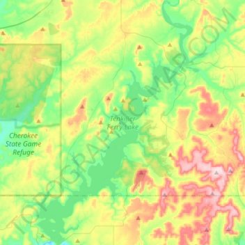
Nom : Carte topographique Tenkiller Ferry Lake, altitude, relief.
Altitude moyenne : 258 m
Altitude minimum : 150 m
Altitude maximum : 448 m