
Carte topographique Ibrahimpatnam
Carte interactive
Cliquez sur la carte pour afficher l’altitude.
À propos de cette carte
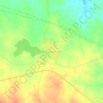
Nom : Carte topographique Ibrahimpatnam, altitude, relief.
Altitude moyenne : 303 m
Altitude minimum : 278 m
Altitude maximum : 324 m
Autres cartes topographiques
Cliquez sur une carte pour visualiser sa topographie, son altitude et son relief.
Khanapur
India > Telangana > Ibrahimpatnam mandal
Khanapur, Ibrahimpatnam mandal, Rangareddy, Telangana, 501506, India
Altitude moyenne : 559 m