
Carte topographique Warrior
Carte interactive
Cliquez sur la carte pour afficher l’altitude.
Warrior
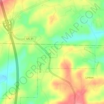
Warrior is in the Central time zone. The elevation at the center of town is 564 feet (172 m), though it ranges from over 620 feet (190 m) north of the center to less than 300 feet (91 m) along the Locust Fork of the Black Warrior River, which forms the southern boundary of the city.
À propos de cette carte
Nom : Carte topographique Warrior, altitude, relief.
Lieu : Warrior, Jefferson County, Alabama, United States (33.83861 -86.81552 33.84150 -86.81154)
Altitude moyenne : 149 m
Altitude minimum : 107 m
Altitude maximum : 193 m