
Carte topographique McKenzie Island
Carte interactive
Cliquez sur la carte pour afficher l’altitude.
À propos de cette carte
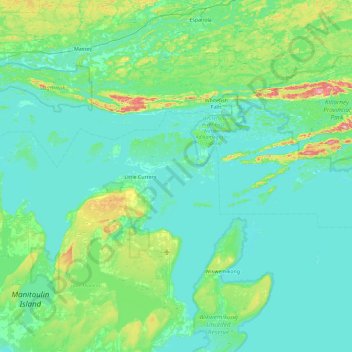
Nom : Carte topographique McKenzie Island, altitude, relief.
Altitude moyenne : 210 m
Altitude minimum : 169 m
Altitude maximum : 471 m
Autres cartes topographiques
Cliquez sur une carte pour visualiser sa topographie, son altitude et son relief.
Rabbit Island
Canada > Ontario > Manitoulin District > Northeastern Manitoulin and the Islands
Rabbit Island, Northeastern Manitoulin and the Islands, Manitoulin District, Northeastern Ontario, Ontario, Canada
Altitude moyenne : 187 m
Little Current
Canada > Ontario > Manitoulin District > Northeastern Manitoulin and the Islands
Little Current, Northeastern Manitoulin and the Islands, Manitoulin District, Northeastern Ontario, Ontario, P0P 1K0, Canada
Altitude moyenne : 193 m