
Carte topographique Tequixquiac
Carte interactive
Cliquez sur la carte pour afficher l’altitude.
Tequixquiac
The municipal seat is located in a small, narrow valley, but most of the municipality is on a high mesa between the Valley of Mexico and the Mezquital Valley. The highest mountain in Tequixquiac is the Cerro Mesa Ahumada, with an elevation of 2,600 metres (8,500 ft) above sea level, on the border between the municipalities of Huehuetoca and Apaxco.
À propos de cette carte
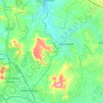
Nom : Carte topographique Tequixquiac, altitude, relief.
Lieu : Tequixquiac, State of Mexico, Mexico (19.82282 -99.22776 19.96444 -99.05861)
Altitude moyenne : 2 296 m
Altitude minimum : 2 167 m
Altitude maximum : 2 705 m