
Carte topographique Angul
Carte interactive
Cliquez sur la carte pour afficher l’altitude.
À propos de cette carte
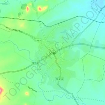
Nom : Carte topographique Angul, altitude, relief.
Lieu : Angul, Anugul, Odisha, 759122, India (20.79824 85.05739 20.87824 85.13739)
Altitude moyenne : 121 m
Altitude minimum : 86 m
Altitude maximum : 237 m
Anugul is located at 21°13′N 86°07′E / 21.21°N 86.11°E / 21.21; 86.11. It has an average elevation of 195 m (640 ft) above sea level. The total geographical area of the district is 6232 km2. From the point of view of area it stands 11th among the 30 Districts of Odisha.