
Carte topographique Gland
Carte interactive
Cliquez sur la carte pour afficher l’altitude.
À propos de cette carte
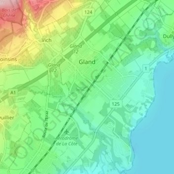
Nom : Carte topographique Gland, altitude, relief.
Lieu : Gland, District de Nyon, Waadt, 1196, Schweiz (46.39529 6.25277 46.43953 6.29687)
Altitude moyenne : 421 m
Altitude minimum : 367 m
Altitude maximum : 559 m
Autres cartes topographiques
Cliquez sur une carte pour visualiser sa topographie, son altitude et son relief.
Gilly
Schweiz > Waadt > District de Nyon
Gilly, District de Nyon, Waadt, 1182, Schweiz
Altitude moyenne : 604 m
Nyon
Schweiz > Waadt > District de Nyon > Nyon
Nyon, District de Nyon, Waadt, 1260, Schweiz
Altitude moyenne : 404 m
Rolle
Schweiz > Waadt > District de Nyon
Rolle, District de Nyon, Waadt, 1180, Schweiz
Altitude moyenne : 394 m