

Carte topographique Machail
Cliquez sur la carte pour afficher l’altitude.
Machail
Machail is a small village at an altitude of 2800m in the Padder Valley of Kishtwar district in Jammu region, 290 km from Jammu city and 66 km from Kishtwar Usually people take 2 days to reach the shrine by foot. On the way there are villages where they can spend the night. The shrine is inaccessible during the winter months of December, January and February.
À propos de cette carte
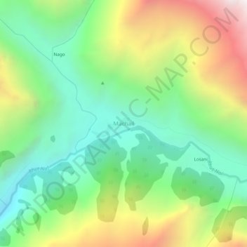
Nom : Carte topographique Machail, altitude, relief.
Lieu : Machail, Atholi (Paddar), Kishtwar, Jammu and Kashmir, India (33.39736 76.32450 33.43736 76.36450)
Altitude moyenne : 3 199 m
Altitude minimum : 2 539 m
Altitude maximum : 4 336 m