
Carte topographique Burera District
Carte interactive
Cliquez sur la carte pour afficher l’altitude.
À propos de cette carte
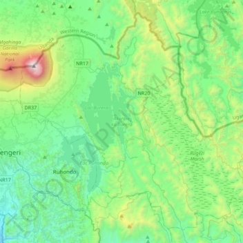
Nom : Carte topographique Burera District, altitude, relief.
Lieu : Burera District, Northern Province, Rwanda (-1.61170 29.65883 -1.30880 29.99875)
Altitude moyenne : 2 059 m
Altitude minimum : 1 476 m
Altitude maximum : 4 084 m
Autres cartes topographiques
Cliquez sur une carte pour visualiser sa topographie, son altitude et son relief.
Rusanze
Rwanda > Northern Province > Musanze > Gataraga
Rusanze, Gataraga, Musanze, Northern Province, Rwanda
Altitude moyenne : 2 078 m
Mount Karisimbi
Rwanda > Northern Province > Gataraga
Mount Karisimbi, Gataraga, Musanze, Northern Province, Rwanda
Altitude moyenne : 3 924 m