

Carte topographique Ambaji
Cliquez sur la carte pour afficher l’altitude.
Ambaji
Ambaji is a town within taluka district Banaskantha, North Gujarat, India. It is located at 24°20′N 72°51′E / 24.33°N 72.85°E / 24.33; 72.85. It is at an altitude of 480 metres (1,570 ft). It is surrounded by the Araveli Hill range. Ambaji is within the Aravali Range'line of peaks', is a range of mountains in western India running approximately 800 km in a northeastern direction across Indian states of Gujarat, Rajasthan, Haryana and Delhi. It is also called Mewat hills locally. Ambaji town also in between the borders of North Gujarat and Abu Road of Rajasthan.
À propos de cette carte
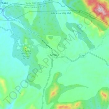
Nom : Carte topographique Ambaji, altitude, relief.
Lieu : Ambaji, Danta Taluka, Banaskantha, Gujarat, 385110, India (24.29328 72.80962 24.37328 72.88962)
Altitude moyenne : 453 m
Altitude minimum : 330 m
Altitude maximum : 916 m