
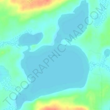
Carte topographique Hilda Lake
Carte interactive
Cliquez sur la carte pour afficher l’altitude.
À propos de cette carte
Nom : Carte topographique Hilda Lake, altitude, relief.
Altitude moyenne : 555 m
Altitude minimum : 545 m
Altitude maximum : 593 m
Autres cartes topographiques
Cliquez sur une carte pour visualiser sa topographie, son altitude et son relief.
Crane Lake
Canada > Alberta > Municipal District of Bonnyville > Happy Hollow
Crane Lake, Happy Hollow, Municipal District of Bonnyville, Alberta, Canada
Altitude moyenne : 562 m
Bourque Lake
Canada > Alberta > Municipal District of Bonnyville
Bourque Lake, Municipal District of Bonnyville, Alberta, Canada
Altitude moyenne : 617 m
Elizabeth Metis Settlement
Canada > Alberta > Municipal District of Bonnyville
Elizabeth Metis Settlement, Municipal District of Bonnyville, Alberta, Canada
Altitude moyenne : 607 m