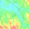
Carte topographique Bowscale Fell
Cliquez sur la carte pour afficher l’altitude.
Bowscale Fell
Being on the Derwent - Eden watershed, Bowscale Fell has further topographical significance by providing the link between the Northern and Eastern Fells. The eastern ridge continues almost imperceptibly beneath Raven Crag, crossing the road before rising again to form Little Eycott and Eycott Hills. From here the watershed runs south across Great Mell Fell and ultimately climbs onto Great Dodd in the Helvellyn range.
À propos de cette carte

Nom : Carte topographique Bowscale Fell, altitude, relief.
Altitude moyenne : 511 m
Altitude minimum : 231 m
Altitude maximum : 701 m
Autres cartes topographiques
Cliquez sur une carte pour visualiser sa topographie, son altitude et son relief.