
Carte topographique Djerba Island
Carte interactive
Cliquez sur la carte pour afficher l’altitude.
À propos de cette carte
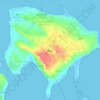
Nom : Carte topographique Djerba Island, altitude, relief.
Lieu : Djerba Island, ربانة, معتمدية جربة ميدون, Médenine, Tunisia (33.63144 10.72751 33.91529 11.06278)
Altitude moyenne : 7 m
Altitude minimum : -6 m
Altitude maximum : 47 m