
Carte topographique Nooitgedacht
Carte interactive
Cliquez sur la carte pour afficher l’altitude.
À propos de cette carte
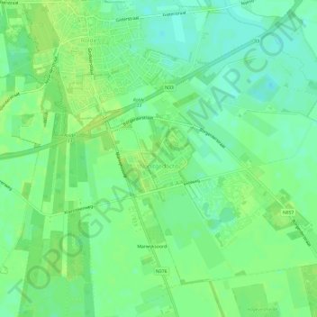
Nom : Carte topographique Nooitgedacht, altitude, relief.
Lieu : Nooitgedacht, Aa en Hunze, Drenthe, Nederland (52.95697 6.65256 52.98518 6.71152)
Altitude moyenne : 16 m
Altitude minimum : 8 m
Altitude maximum : 20 m
Autres cartes topographiques
Cliquez sur une carte pour visualiser sa topographie, son altitude et son relief.
Oud Annerveen
Oud Annerveen, Aa en Hunze, Drenthe, Nederland
Altitude moyenne : 2 m
Oosterbroek
Oosterbroek, Eelde, Tynaarlo, Drenthe, Nederland, 9761 TG, Nederland
Altitude moyenne : 3 m
Oosterhesselen
Nederland > Drenthe > Coevorden
Oosterhesselen, Coevorden, Drenthe, Nederland
Altitude moyenne : 15 m
Uffelte
Nederland > Drenthe > Westerveld
Uffelte, Westerveld, Drenthe, Nederland
Altitude moyenne : 6 m
Nieuw-Buinen
Nederland > Drenthe > Nieuw-Buinen
Nieuw-Buinen, Borger-Odoorn, Drenthe, Nederland
Altitude moyenne : 7 m