
Carte topographique Daocheng County
Carte interactive
Cliquez sur la carte pour afficher l’altitude.
À propos de cette carte
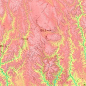
Nom : Carte topographique Daocheng County, altitude, relief.
Lieu : Daocheng County, Kardze, Sichuan, 627700, China (27.96542 99.84888 29.70734 100.61317)
Altitude moyenne : 3 926 m
Altitude minimum : 1 962 m
Altitude maximum : 5 922 m
Daocheng County or Dapba in Tibetan (Tibetan: འདབ་པ་རྫོང་།; Chinese: 稻城县) is a county of western Sichuan Province, China, located in the eastern Hengduan Mountains. It is under the administration of the Garzê Tibetan Autonomous Prefecture with an overwhelmingly Tibetan population. Its latitude ranges from 27° 58' to 29° 30' N and longitude 99° 56' to 100° 36', and reaches 174 kilometres (108 mi) in north–south extent and 63 km (39 mi) in east–west width, with elevations ranging from 2,000 to 6,032 m (6,562 to 19,790 ft).
Autres cartes topographiques
Cliquez sur une carte pour visualiser sa topographie, son altitude et son relief.
Jiuzhaigou
China > Sichuan > Jiuzhaigou County
Jiuzhaigou, Jiuzhaigou County, Ngawa Tibetan and Qiang Autonomous Prefecture, Sichuan, 623400, China
Altitude moyenne : 2 520 m
Ngawa Tibetan and Qiang Autonomous Prefecture
Ngawa Tibetan and Qiang Autonomous Prefecture, Sichuan, China
Altitude moyenne : 3 542 m
Ngawa
China > Sichuan > Ngawa County
Ngawa, Ngawa County, Ngawa Tibetan and Qiang Autonomous Prefecture, Sichuan, 624600, China
Altitude moyenne : 3 744 m
巴拉格宗雪山
China > Sichuan > Dêrong County
巴拉格宗雪山, Dêrong County, Kardze, Sichuan, China
Altitude moyenne : 4 772 m
Mount Emei
Mount Emei, Emeishan City, Leshan City, Sichuan, China
Altitude moyenne : 2 443 m