Géolocaliser

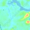
Carte topographique Perambra

Cliquez sur la carte pour afficher l’altitude.

À propos de cette carte

Nom : Carte topographique Perambra, altitude, relief.

Lieu : Perambra, Koyilandi, Kozhikode, Kerala, 673525, India (11.51973 75.71812 11.59973 75.79812)

Altitude moyenne : 27 m

Altitude minimum : 2 m

Altitude maximum : 139 m

Autres cartes topographiques

Cliquez sur une carte pour visualiser sa topographie, son altitude et son relief.
Kayanna

India > Kerala > Koyilandi > Kayanna Bazar

Altitude moyenne : 67 m

vayalada

India > Kerala > Koyilandi > Vattachira

Altitude moyenne : 214 m

Moodadi

India > Kerala > Koyilandi > Thikkodi

Altitude moyenne : 10 m

Balussery

India > Kerala > Koyilandi > Balusseri

Altitude moyenne : 39 m

Kariyathumpara

India > Kerala > Koyilandi > Vallayil Thazhe

Altitude moyenne : 543 m

Malabar WLS

India > Kerala > Koyilandi > Vythiri

Altitude moyenne : 932 m

Kuttiyadi river

India > Kerala > Koyilandi > Peruvannamuzhi

Altitude moyenne : 112 m

Balussery

India > Kerala > Koyilandi > Panayi

Altitude moyenne : 39 m

Unnikulam

India > Kerala > Koyilandi > Karumala

Altitude moyenne : 52 m

Équipez-vous pour votre prochaine aventure :

📦Boîte de rangement étanche - Protégez vos munitions ou électronique de l'humidité
🥤Gourdes isothermes - Gourdes pour garder l'eau chaude ou froide
🔒Antivol de vélo haute sécurité - Protégez votre vélo lors de vos haltes en ville ou en parc
⛺Tentes légères - Tentes compactes pour trekking
🥤Poches à eau - Systèmes d'hydratation pour sac à dos

En tant que Partenaire Amazon, ce site perçoit une commission sur les achats éligibles sans surcoût pour vous.