
Carte topographique Tonbridge and Malling
Carte interactive
Cliquez sur la carte pour afficher l’altitude.
À propos de cette carte
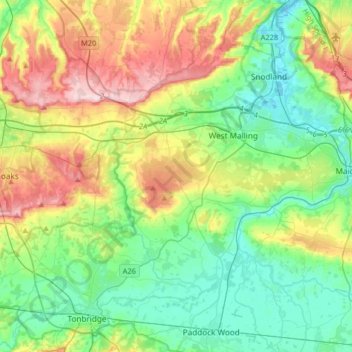
Nom : Carte topographique Tonbridge and Malling, altitude, relief.
Lieu : Tonbridge and Malling, Kent, South East, England, United Kingdom (51.17470 0.20052 51.36876 0.52675)
Altitude moyenne : 77 m
Altitude minimum : -3 m
Altitude maximum : 236 m