
Carte topographique Dihlabeng Ward 20
Carte interactive
Cliquez sur la carte pour afficher l’altitude.
À propos de cette carte
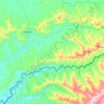
Nom : Carte topographique Dihlabeng Ward 20, altitude, relief.
Altitude moyenne : 1 975 m
Altitude minimum : 1 615 m
Altitude maximum : 3 100 m
Autres cartes topographiques
Cliquez sur une carte pour visualiser sa topographie, son altitude et son relief.
Swartkrans
RSA > Free State > Dihlabeng Local Municipality
Swartkrans, Dihlabeng Local Municipality, Thabo Mofutsanyana District Municipality, Free State, RSA
Altitude moyenne : 2 036 m
Golden Gate Highlands National Park
RSA > Free State > Dihlabeng Local Municipality
Golden Gate Highlands National Park, Blesbok Loop, Dihlabeng Ward 20, Dihlabeng Local Municipality, Thabo Mofutsanyana District Municipality, Free State, RSA
Altitude moyenne : 2 065 m