
Carte topographique Salto
Carte interactive
Cliquez sur la carte pour afficher l’altitude.
À propos de cette carte
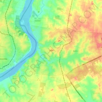
Nom : Carte topographique Salto, altitude, relief.
Lieu : Salto, 50000, Uruguay (-31.41614 -57.99652 -31.36290 -57.87881)
Altitude moyenne : 34 m
Altitude minimum : -3 m
Altitude maximum : 74 m
Built on hills and bluffs, the city is situated near the Rio Uruguay's 'big jump' falls, which is also the location of the Salto Grande Dam. The land is low lying alongside the river bank, with an elevation of 48 metres (157 ft) above sea level.