
Carte topographique Green Lake
Carte interactive
Cliquez sur la carte pour afficher l’altitude.
À propos de cette carte
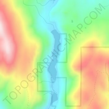
Nom : Carte topographique Green Lake, altitude, relief.
Altitude moyenne : 678 m
Altitude minimum : 471 m
Altitude maximum : 951 m
Autres cartes topographiques
Cliquez sur une carte pour visualiser sa topographie, son altitude et son relief.
Brown Lake
United States of America > Washington > Okanogan County > Brown Lake
Brown Lake, Okanogan County, Washington, United States of America
Altitude moyenne : 719 m