
Carte topographique Slide Mountain Wilderness
Carte interactive
Cliquez sur la carte pour afficher l’altitude.
Slide Mountain Wilderness
Within its boundaries lie 10 of the 35 Catskill High Peaks, including the highest Catskill peak, Slide, 4,180 feet (1277 m) of elevation; and lowest, Rocky.
À propos de cette carte
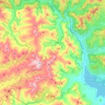
Nom : Carte topographique Slide Mountain Wilderness, altitude, relief.
Altitude moyenne : 584 m
Altitude minimum : 174 m
Altitude maximum : 1 262 m