
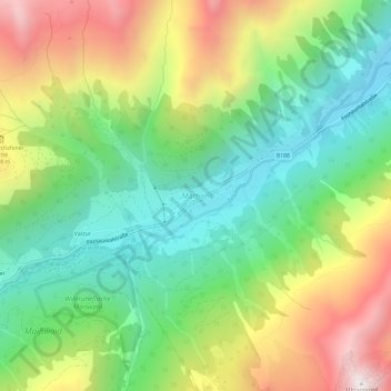
Carte topographique Mathon
Carte interactive
Cliquez sur la carte pour afficher l’altitude.
À propos de cette carte
Nom : Carte topographique Mathon, altitude, relief.
Altitude moyenne : 1 892 m
Altitude minimum : 1 375 m
Altitude maximum : 2 716 m
Autres cartes topographiques
Cliquez sur une carte pour visualiser sa topographie, son altitude et son relief.
Brand
Oostenrijk > Tirol > Bezirk Landeck > Gemeinde Ischgl > Ischgl
Brand, Ischgl, Gemeinde Ischgl, Bezirk Landeck, Tirol, 6561, Oostenrijk
Altitude moyenne : 1 803 m