
Carte topographique Yantai
Carte interactive
Cliquez sur la carte pour afficher l’altitude.
À propos de cette carte
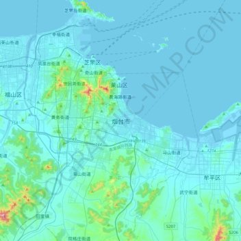
Nom : Carte topographique Yantai, altitude, relief.
Altitude moyenne : 34 m
Altitude minimum : -3 m
Altitude maximum : 546 m
Yantai is located along the north coast of the Shandong Peninsula, south of the junction of Bohai Sea and Yellow Sea and parallel to the southern coast of Liaoning. The topographical breakdown consists of: