
Carte topographique Piedecuesta
Carte interactive
Cliquez sur la carte pour afficher l’altitude.
À propos de cette carte
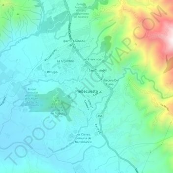
Nom : Carte topographique Piedecuesta, altitude, relief.
Lieu : Piedecuesta, Santander, 681011, Colombia (6.96912 -73.09019 7.00877 -73.03441)
Altitude moyenne : 1 107 m
Altitude minimum : 886 m
Altitude maximum : 1 928 m
Autres cartes topographiques
Cliquez sur une carte pour visualiser sa topographie, son altitude et son relief.
Chicamocha Real
Colombia > Santander > Piedecuesta
Chicamocha Real, Pescadero, Piedecuesta, Santander, RAP Gran Santander, Colombia
Altitude moyenne : 724 m
Filo De La Mesa De Los Santos
Colombia > Santander > Piedecuesta
Filo De La Mesa De Los Santos, Piedecuesta, Santander, Colombia
Altitude moyenne : 1 329 m